
Industries · Logistics · Waterways · South America

Logistics & Waterways in South America

South America’s logistics systems determine whether agricultural output, minerals, fuels and industrial goods can move through river, road, rail and port corridors from inland production areas to regional and global markets.
Econosur Industry Analysis Ports · Corridors · Customs Updated September 6, 2026
Logistics and waterways in South America with ports, river corridors and freight infrastructure
Market access Production becomes market value only when corridors, ports and operators work.
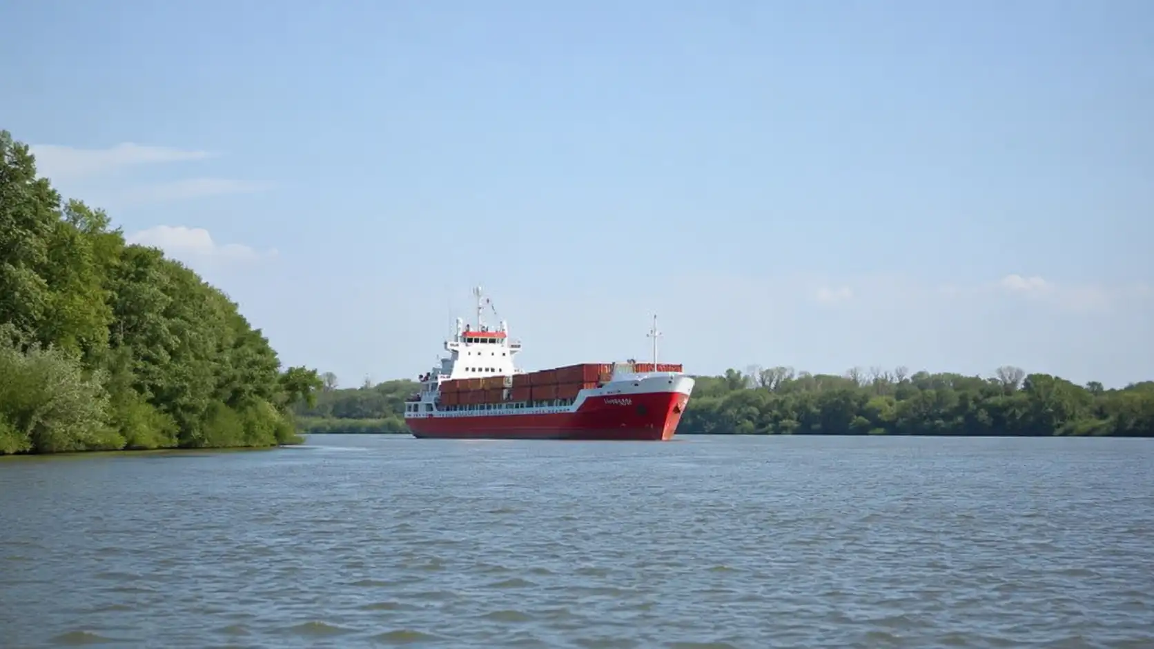
Ports, waterways and inland trade corridors connect South America’s production systems with Atlantic and Pacific markets. Image: Econosur.
3,442 km Official length of the Paraguay–Paraná Waterway from Puerto Cáceres to Nueva Palmira
25 years Concession period awarded for the Argentine trunk waterway in 2026
40 ft / 12.2 m Planned later-stage channel depth on the lower Paraná; roughly 38 ft / 11.6 m navigable draft under the referenced clearance logic
75.7m t Gran Rosario agro-export shipments in 2025, ranking the node first worldwide
Quick answer

Logistics is the execution layer behind South America’s production economy.

Agriculture, mining, energy and manufacturing create commercial value only when goods, equipment and inputs can move through roads, railways, waterways, terminals, ports and customs systems.

The Paraná–Paraguay Waterway is the region’s most important river-based example. It connects inland production with downstream ports and Atlantic-facing markets while concentrating exposure to water levels, dredging, terminal capacity and cross-border regulation.

Paraguay now also illustrates the road-corridor side of the same problem. The Bioceanic Bridge to Brazil is physically connected, but road access, customs infrastructure and the onward route through Argentina to Chile still determine when that connection becomes a predictable freight corridor.

2026 market update: river and road corridors move from plans into execution

Argentina’s Vía Navegable Troncal: Argentina awarded the new 25-year concession through ANPYN Resolution 36/2026 and signed the concession contract on July 7, 2026 with the Jan De Nul–Servimagnus consortium, which created Vía Navegable Argentina S.A. for the contract. The concession framework covers dredging, redredging, signaling, hydrometric monitoring, maintenance, modernization and development works.

The government presented the new concession with a 13.5% reduction in the future toll structure. However, Resolution 105/2026, issued on August 4, extended the existing USD 1.30 per net register ton international tariff until the effective takeover of the service by the concessionaire. For that reason, Econosur treats contract signature and effective operational takeover as separate evidence points unless a later official takeover record confirms the transition.

On August 7, Argentina formalized the Consejo de Control de la Vía Navegable Troncal under Resolution 47/2026. The body is designed to monitor and analyze the concession with participation from provinces, users and technical stakeholders. For companies, this adds a more structured public-monitoring layer around works, traffic, maintenance and investment execution.

The planned later-stage target is a 40-foot (12.2-metre) channel on the lower Paraná, not a 40-foot vessel draft. Argentina’s ports authority has described 40 feet of channel depth as corresponding to roughly 38 feet (11.6 metres) of navigable draft under the referenced clearance logic. The commercial issue is therefore not the headline depth alone, but usable draft, vessel class, maintenance, tolls and whether ships can load more cargo at Gran Rosario. See How a Deeper Paraná River Could Reshape Mercosur Trade for the route-level freight and completion-loading implications, and the broader Paraná–Paraguay Waterway analysis for the five-country system.

Gran Rosario: the latest full-year data underline the scale of that commercial question. The Bolsa de Comercio de Rosario reports that the node shipped 75.7 million tonnes of grains, oils and agricultural by-products in 2025, ahead of New Orleans and Santos and therefore ranking first among the world’s agro-export port nodes that year. The same 70-kilometre corridor contains 30 port terminals.

Paraguay’s navigation capacity: the Administración Nacional de Navegación y Puertos has reinforced its own waterway-maintenance capability with the DRM-5 “Paraguay”, a cutter-suction dredger with an approximate dredging capacity of 1,500 m³ per hour. In August, ANNP also reiterated the objective of a navigable route operating 24 hours a day, 365 days a year on the shared Alto Paraná system.

Current hydrology: the Instituto Nacional del Agua’s September 4 report placed Rosario at 2.55 metres and classified the section as medium-low to medium water. Paraná and Santa Fe were in the same broad range. These readings are not a corridor-wide capacity measure, but they underline why structural channel depth, current water level and actual usable draft must be treated as separate variables in route planning.

Bioceanic Corridor: the Carmelo Peralta–Porto Murtinho bridge is physically connected, while the surrounding road system continues to advance in separate stages. On August 3, Paraguay’s MOPC reported 40% physical progress on Lote 3 of PY15. The corridor therefore remains a useful test of the difference between a visible infrastructure milestone and end-to-end freight readiness.

In South America, production capacity becomes market power only when the corridor works.

Logistics is a system, not a transport asset

A port, road or river does not create reliable market access on its own. Commercial execution depends on the interaction between infrastructure, operators, regulation, documentation, storage, financing and cargo demand.

A functioning trade corridor must move goods predictably between production areas, inland terminals, border points, processing centres and external markets.

01 Production Origin

Farms, mines, factories and energy projects create cargo demand.

02 Inland access Connection

Roads, railways and feeder services connect production to terminals.

03 Terminal Handling

Storage, loading, inspection and cargo consolidation occur here.

04 Corridor Movement

Rivers, highways and rail systems move cargo at regional scale.

05 Market Delivery

Ports and downstream connections provide access to buyers.

Physical layer: rivers, ports, roads, railways, terminals, fleets, warehouses and storage systems.

Operational layer: operators, customs, documentation, border procedures, cargo handling and service reliability.

Commercial layer: cargo demand, delivery timing, buyer requirements, cost structures and regional market strategy.

Different countries play different logistics roles

Argentina

Agro-export and energy corridors

Argentina combines the Rosario and Up-River agro-export system with Vaca Muerta logistics, inland production corridors and Atlantic-facing ports.

Brazil

Continental production scale

Brazil’s logistics system connects agribusiness, mining and manufacturing with major ports while managing long distances, road pressure and rail expansion.

Paraguay

River access and an emerging east-west corridor

Paraguay’s established export system depends on barge fleets, river terminals and the Paraguay–Paraná Waterway. The Bioceanic Corridor is adding a second logistics axis toward Brazil, northern Argentina and Pacific ports, but end-to-end freight readiness is still incomplete.

Uruguay

Port and service platform

Uruguay’s role is shaped by Montevideo, Nueva Palmira, free-port structures and its position within the Río de la Plata logistics system.

Bolivia

Eastern river access

Bolivia connects to the wider Hidrovía through the Paraguay River, Canal Tamengo and inland port infrastructure in the east.

Chile

Pacific and cross-border access

Chile is connected through Pacific ports, mining corridors, mountain crossings and the wider Atlantic–Pacific corridor discussion.

River corridor: the Paraná–Paraguay system moves high-volume cargo through inland navigation, barge fleets and downstream Atlantic terminals.

Bioceanic corridor: the Capricornio route now has a physically connected Paraguay–Brazil bridge, but the commercial corridor remains incomplete. Its value depends on finished road links, border infrastructure, customs coordination, cargo density, Andean crossings and reliable Pacific port access.

The decision points that determine corridor performance

Decision point Operational question Commercial effect
Navigable depth Can vessels and barges load at economically efficient levels? Determines capacity, rotations and cost per ton.
Terminal capacity Can cargo be stored, inspected and loaded without congestion? Influences waiting times and shipment reliability.
Customs execution Are documentation, controls and clearance processes predictable? Affects lead times, inventory and buyer confidence.
Border coordination Do different jurisdictions apply compatible procedures? Determines whether a cross-border route functions as one corridor.
Operator capacity Are vessels, trucks, warehouses and service providers available? Shapes scalability and peak-season resilience.
Climate exposure How sensitive is the route to low water, flooding or extreme weather? Changes cost, timing and supply-chain risk.

Subsectors within logistics and waterways

River logistics

Waterways and barge systems

Navigation, dredging, barge fleets, river terminals, signaling, shipyards and downstream connections.

Maritime logistics

Ports and terminals

Container handling, bulk terminals, fuel terminals, storage, vessel access and port services.

Inland transport

Road and rail corridors

Trucking, railway links, dry ports and multimodal connections between production and export infrastructure.

Trade execution

Customs and border systems

Documentation, clearance, inspections, scanning, phytosanitary controls and trade facilitation.

Specialized handling

Cold chain and industrial cargo

Refrigerated goods, food exports, pharmaceuticals, equipment and high-value industrial inputs.

Digital layer

Visibility and logistics technology

Tracking, fleet management, port systems, customs digitization and supply-chain data.

Business opportunities are concentrated in the friction layer

The sector creates demand for port operators, barge companies, freight forwarders, customs specialists, warehouse operators, cold-chain providers, infrastructure contractors and logistics technology companies.

The clearest opportunities often appear where the system fails to perform smoothly: delays, limited storage, fleet shortages, poor cargo visibility, documentation friction, terminal congestion and weak multimodal coordination.

Infrastructure

Capacity and maintenance

Dredging, terminals, warehouses, road access, rail connections and specialized handling equipment.

Operations

Reliability services

Fleet capacity, forwarding, customs execution, maintenance, inspection and cargo scheduling.

Technology

Supply-chain visibility

Tracking, port-management systems, digital documents, fleet software and predictive planning.

Market analysis

Corridor-specific analysis

Route comparison, logistics exposure, operator mapping, supplier assessment and market-access analysis.

Marcus A. Volz Perspective

The asset is not the corridor

My reading is that South America’s logistics problem is often not the absence of infrastructure, but incomplete corridor execution.

The Paraná and the Bioceanic Corridor illustrate the same principle from different directions. A deeper navigation channel creates no commercial advantage unless usable draft, maintenance, vessel economics and downstream interfaces improve with it. A new bridge creates no predictable freight corridor unless roads, customs, border systems, operators and sufficient cargo demand work around it.

For companies, the relevant unit of analysis is therefore not an individual bridge, port, dredging project or highway. It is the complete route from production site or supplier to terminal, border, vessel and buyer — including the points where another operator, public authority or hydrological constraint can change cost, timing or capacity.

The commercial question is not whether infrastructure exists. It is whether the full corridor can be used reliably at the required cost and scale.

Companies & operators

Who controls, uses and depends on the corridor

Corridor economics are shaped by different types of companies: concessionaires that maintain access, transport operators that move cargo, industrial users whose output depends on the route, and public or state-linked companies that influence terminal and fuel flows.

Vía Navegable Argentina S.A.Dedicated company created by Jan De Nul and Servimagnus for the 25-year Argentine trunk-waterway concession.
Jan De Nul & ServimagnusConcession partners responsible for the new Vía Navegable Troncal operating framework, including dredging, signaling and modernization.
Navios South American LogisticsRiver-logistics operator with barges, tanker vessels and terminal activities across the Hidrovía system.
ParacelLarge Paraguayan industrial project whose pulp logistics rely on river transport and downstream export connections.
PETROPARState-linked fuel company relevant to Paraguay’s imported-fuel and terminal logistics system.
ANNP / ANPYNParaguay’s and Argentina’s public navigation authorities influence dredging, monitoring, port infrastructure and corridor governance.
Commercial questions

Three questions companies need answered

Which logistics bottlenecks could materially change delivery cost, timing or capacity for a specific South American supply chain?

Public maps show routes, but company exposure depends on the exact cargo, terminal, season, navigable depth, border process, storage requirement and fallback option. A corridor that looks efficient at regional level can still contain one operational point that changes the economics of a shipment.

Which operators, terminals, concessionaires and infrastructure owners actually control access to the relevant corridor?

The answer differs by cargo and geography. River concessions, private terminals, barge operators, public ports, road contractors, customs authorities and industrial cargo owners can each control a different part of execution. Identifying the real decision-makers is more useful than treating “logistics” as one homogeneous market.

Where do announced infrastructure improvements translate into commercially accessible demand for suppliers and service providers?

A bridge, dredging plan or terminal investment may be publicly visible long before supplier packages, qualification requirements, maintenance budgets or procurement routes are clear. The commercial task is to separate physical progress from addressable demand.

Public record vs. commercial reality

What public sources show — and what they usually do not

Official sources are strong for concession terms, construction progress, route design, water levels, public investment and regulatory decisions. They are much weaker on the live commercial layer that determines whether a supplier can actually win business.

Publicly visibleProject design, concession status, announced depth targets, road progress, river levels, permits, regulations and institutional responsibilities.
Usually fragmentedWhich operators are actively expanding capacity, how terminal demand differs by cargo, and where bottlenecks are affecting real schedules or costs.
Often not publicBuyer priorities, incumbent suppliers, qualification rules, procurement timing, local-service expectations and whether a specific opportunity is commercially accessible.
Econosur research services

From corridor data to commercial decisions

Econosur can move beyond public infrastructure reporting and verify how a specific corridor affects a company, supplier category or project.

Corridor & Logistics Risk AnalysisRoute, depth, terminal, border, transport-capacity and disruption analysis for a defined cargo flow or supply chain.
Operator, Buyer & Supplier MappingIdentify concessionaires, terminals, logistics operators, buyers, incumbent suppliers and relevant qualification or procurement structures.
Commercial Validation & Field ResearchTest whether announced infrastructure, maintenance or capacity investments are creating real supplier demand and commercially accessible opportunities.
Explore custom market analysis

Need corridor-specific commercial research?

Public infrastructure data can show where a corridor is changing. Econosur focuses on what those changes mean for operators, buyers, suppliers, delivery risk and commercial accessibility.

See logistics research services

Frequently asked questions

Why do logistics and waterways matter in South America?

Logistics and waterways determine whether agricultural goods, minerals, fuels, industrial products and consumer goods can move reliably from production areas to ports, cities and export markets.

Why is the Paraná-Paraguay Waterway strategically important?

The waterway connects inland production areas with river terminals, the Río de la Plata and Atlantic-facing shipping routes. It is particularly important for Paraguay and Argentina’s agro-export system.

Which countries are most relevant to this sector?

Argentina, Brazil, Paraguay and Uruguay are central to Atlantic-facing logistics. Bolivia connects through the Paraguay River, while Chile is important through Pacific ports and cross-border corridors.

What matters beyond ports and rivers?

Logistics outcomes also depend on roads, rail, storage, customs, border procedures, dredging, terminals, cold chains, trucking capacity, digital systems and regulatory coordination.

How do logistics affect agriculture, mining and energy?

Production becomes market value only when goods, equipment and inputs can move. These sectors therefore depend on corridors, ports, storage, transport services and reliable export routes.

What separates a transport route from a functioning trade corridor?

A route is a physical connection. A functioning corridor combines infrastructure, operators, services, customs, border procedures, terminals, financing and sufficient commercial demand. Paraguay’s Bioceanic Bridge illustrates the distinction: the bridge is physically connected, while access roads and border systems remain incomplete.

What does a planned 40-foot Paraná River channel mean?

The planned later-stage target refers to a channel depth of 40 feet, or about 12.2 metres, on the lower Paraná. Channel depth is not the same as vessel draft. Under the clearance logic described by Argentina’s ports authority, a 40-foot channel corresponds to roughly 38 feet, or 11.6 metres, of navigable draft.

How does Econosur analyze logistics and waterways?

Econosur analyzes the sector as a commercial-execution system, focusing on whether infrastructure, services, regulation, operators and commercial demand align strongly enough to support trade and investment.

Econosur Analysis

About this industry analysis

This page is part of Econosur’s industry analysis for South America. It connects physical infrastructure with operational execution, regional trade flows and company-level commercial questions.

Primary and official sources are used for concession status, construction progress, hydrology and regulatory decisions; institutional and market sources are used for cargo and operator context; secondary sources are used where they add interpretation or a counterpoint. Commercial questions such as buyer priorities, supplier positions, qualification routes and project accessibility require separate company-level verification.

The analysis was prepared by Marcus A. Volz, market analyst and international B2B consultant, and founder of Econosur.

Econosur Analysis · Marcus A. Volz, Market Analyst / International B2B Consultant · Updated September 6, 2026.
Scroll to Top